Field trip 2025 to Fehmarn
29 August 2025

Photo: UHH/Li
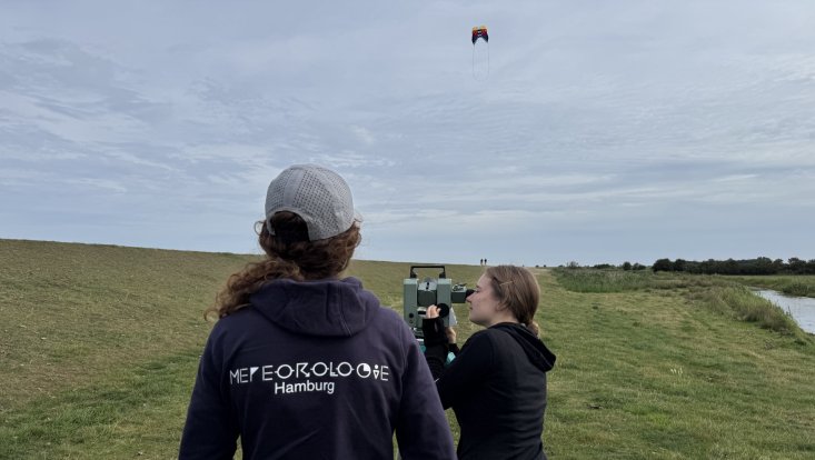
A reflection on classical aerology — that is the study of the atmosphere at higher altitudes — using modern techniques is just one of three main focus points of this year's meteorological field trip on Fehmarn. Students in the Master's program Atmospheric Science after their second semester learn how to plan, conduct, and analyze meteorological field measurements. For example, a kite staying in the air for several hours is photographed every 10 seconds with a 180° cloud camera. The position of the kite in the images is then used to determine wind speed and direction. A modern wind LIDAR, which makes precise measurements up to 200 meters altitude with a laser, serves as a reference instrument. Additionally, a radiosonde attached to the kite transmits its position and also measures temperature, humidity, and air pressure, allowing for the precise determination of the kite's altitude. Other experiments include studies on island climate, for which twelve automatic weather stations had already been deployed across the entire island in early August, and AI-supported recognition of cloud types from camera images.
(This news article was translated from German to English by UHHGPT.)


